When creating a fund on ActionFunder, you can define exactly where you want to support – from a simple radius to a precisely drawn area. This means only non-profits operating in the right places will match with your fund.
Location options
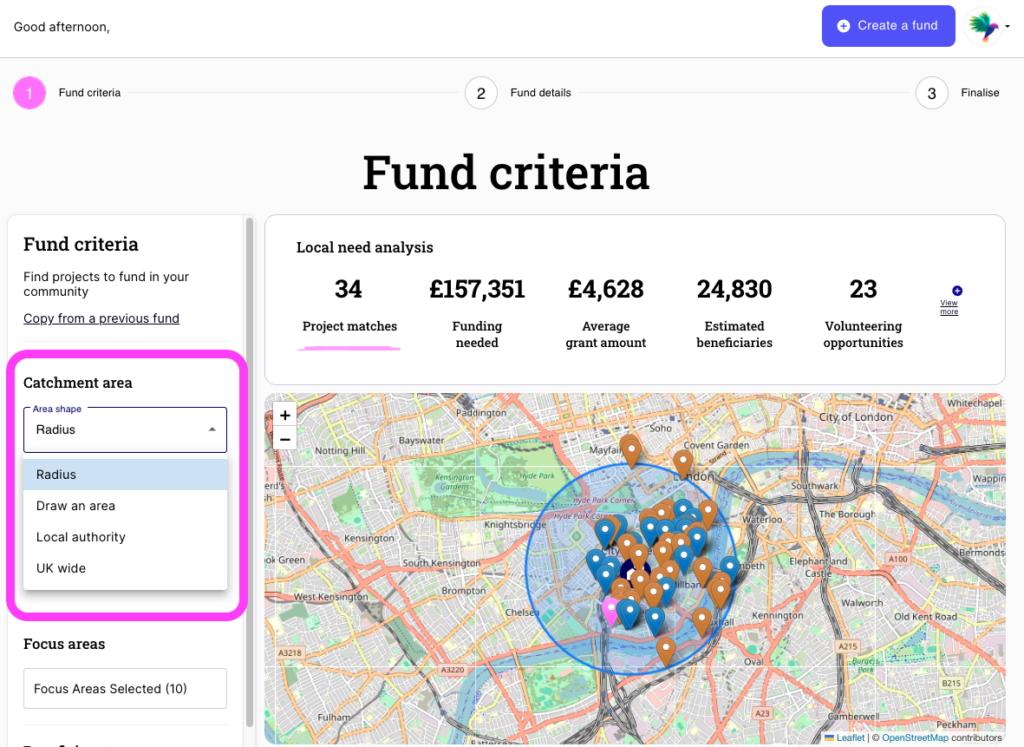
Radius
Enter a postcode and choose a distance in miles. ActionFunder will draw a circle around that postcode, so only non-profits operating within that radius will match with your fund. Useful when your fund covers a straightforward geographic area, like a town or neighbourhood.
Draw an area
Use the map tool to draw a custom boundary freehand. Ideal when your target area doesn’t follow standard boundaries – for example, a river valley, a housing estate, or a cluster of wards.
Local authority
Select one or more local authority areas. A good fit if your funding remit aligns with council or administrative boundaries.
UK wide
For funds available UK wide
Customisable area
If your organisation already has defined service areas – for example, a shapefile or boundary dataset used internally – we can upload these directly to your fund as a customisable map.
This is particularly useful for:
- Utility or infrastructure providers with licensed service territories
- Health or local authority partners working to predefined catchments
- Funders managing multiple distinct geographic programmes
To set this up, speak to your Customer Success Manager or get in touch at customersuccess@actionfunder.org.
Need help?
If you’re unsure which location option is right for your fund, contact us at customersuccess@actionfunder.org and we’ll help you get it right.